Sample Data
Every capture includes rich, verified metadata. Here's a real example:
GLO-HYD-DR70WD-001-93
Fire Hydrant
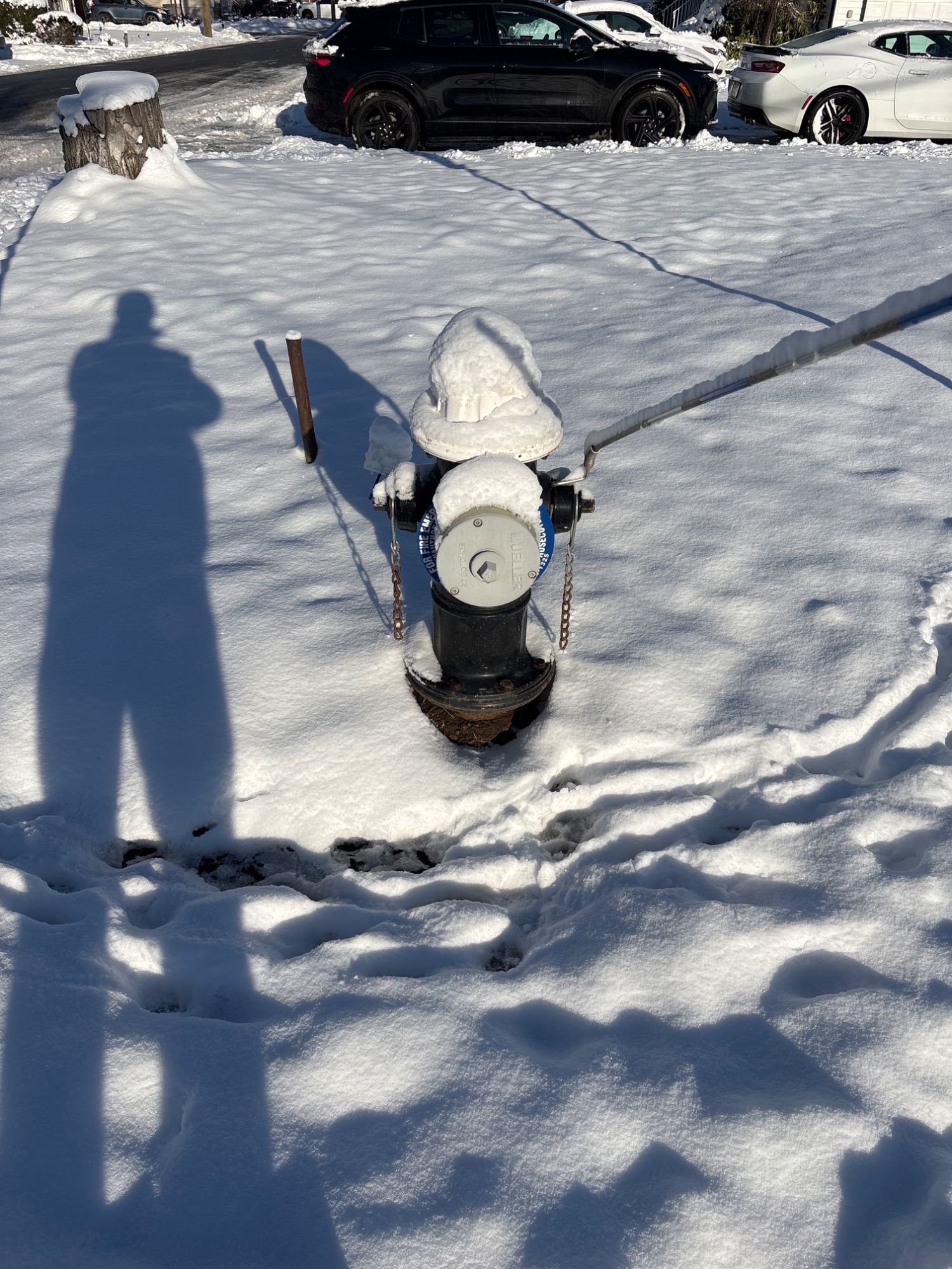
Location
40.881352, -74.241741
Address
96 Strickland Avenue, Little Falls, NJ 07424
GPS Accuracy
4.7 meters
Altitude
55.1 meters
Captured
2026-01-19 at 9:16 AM EST
Compass Heading
332° (NNW)
Device Tilt
52°
Condition
Undamaged
Geohash
DR70WD
Image Hash (SHA-256)
2e0a28ff2994...bac80ab28
Multiple captures of the same object are linked by Object ID, creating temporal history.
×
![]()